How drones are innovating mapping


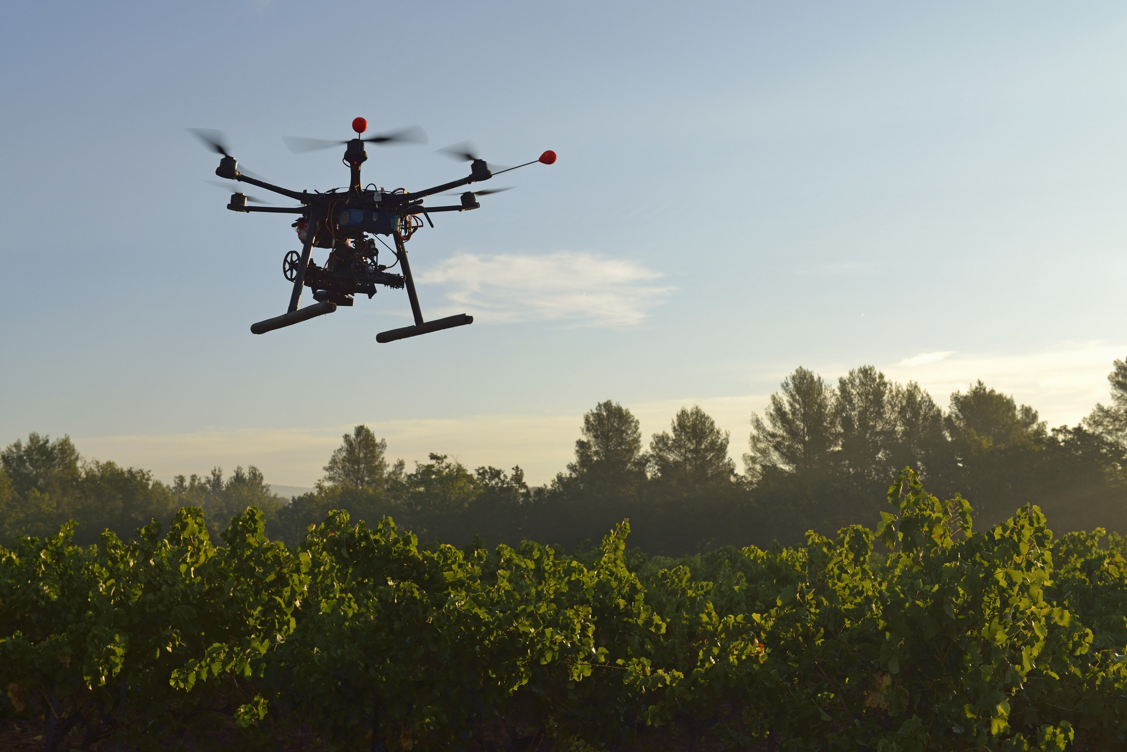
Drones aren't just for Amazon deliveries, lethal airstrikes, and unsanctioned White House lawn landings. They're also redrawing maps.
Traditionally, a civilian mapping an area required a helicopter, plane, or satellite. Those options are all costly and require recruiting people with specific skill sets. And you might be able to afford a flyover of a particular mappable area just once or twice a year.
But today, a few hundred bucks is enough to make anyone a drone owner. And from there, mapping is a matter of simply downloading the right software to the aircraft, and then taking it for an unmanned spin, a practice easily replicable on a far more frequent basis than the traditional alternatives. One option is Maps Made Easy, a product from San Diego-based store Drones Made Easy.
The Week
Escape your echo chamber. Get the facts behind the news, plus analysis from multiple perspectives.

Sign up for The Week's Free Newsletters
From our morning news briefing to a weekly Good News Newsletter, get the best of The Week delivered directly to your inbox.
From our morning news briefing to a weekly Good News Newsletter, get the best of The Week delivered directly to your inbox.
Anyone can use the app to get a drone to map, say, a football field, and then upload the results to a cloud-based system for a free or cheap result within hours, depending on the size of the project, said Drones Made Easy CTO Tudor Thomas. With the software downloaded, a drone owner simply draws the desired parameters of the flyover. From there, the device can take off. In a process called photogrammetry, the vehicle methodically flies back and forth across the area, taking images at specific intervals. After the drone finishes, getting a map is a matter of popping its SD card into your computer, uploading the footage into the company's cloud-based system, and waiting for the program to spit out a map.
Where before it could take months to map an area, drones now offer 3D maps within a matter of hours or days. Drone mapping updates can go so fast that even Google Maps doesn't keep pace with them. Compare that to rural areas in the U.S. that typically get a mapping flyover once every five years. Elsewhere, waits can be even longer.
"Because [drones are] so cheap to operate and so easy to operate, you can take relatively frequent measurements. 'Okay, yesterday this was here and today it's not here,'" said Alexander Stimpson, a research scientist at Duke University's Humans and Autonomy Lab. "If you're trying to pay for a private aircraft to fly you around and take images, maybe you can do that twice a year."
There are a host of practical reasons individuals and organizations seek out up-to-date mapping information. Having a map facilitates cemetery plotting, mining, and documenting archaeological sites. Construction workers building a Walmart in Fort Lauderdale, Florida, used Maps Made Easy to monitor their progress with aerial maps, Thomas said.
A free daily email with the biggest news stories of the day – and the best features from TheWeek.com
Mapping also bolsters environmental and humanitarian causes. Drone mapping can be used to track endangered animals' traveling patterns without humans and cars disrupting their habitats. It's also a relatively subtle way of surveilling poachers. Increasingly, aid workers are employing third parties skilled in drone mapping to pitch in on natural disaster relief. Thermal imaging allows rescuers to identify buildings where people may be trapped. It's safer to first send a drone to dangerous areas than to send humans and risk adding to the death toll. Similarly, Thomas said he hopes drone mapping will catch on in firefighting as the technology advances, by using a thermal camera to safely apply retardant to wildfires overnight.
One particularly promising application of drone mapping is in agriculture. Getting a clearer picture of what crops look like beyond what a farmer can assess anecdotally is key to making data-driven decisions that increase yield. Raptor Maps, a Massachusetts Institute of Technology-backed startup, is working to give farmers the precise information they need.
"Farmers are not what you view as the traditional guy in the field with a pitchfork and a hoe," said Raptor Maps COO Forrest Meyen. "Really, they're business managers of complex operations. Everything that they do has to increase their return on investment."
Raptor Maps hopes its drone mapping becomes an integral part of farming. If they can feed their data to a John Deere smart tractor, sussing out something like which areas of corn need more nitrogen becomes easy to identify and then act on, with less room for human error.
Drone mapping isn't perfect. The quality of your maps is dependent on the quality of the sensors you buy. Flight time is also fairly limited, so there might be a lot of stopping and starting involved in mapping a large area. And as the Federal Aviation Administration continues to impose new regulations on drones, they stand to restrict flying for commercial use in ways that make mapping a more tedious process. Overall, though, regulations can go a long way toward legitimizing drone mapping, even as negative anecdotes reinforce stereotypes about drones.
"There's always going to be the idiot that doesn't follow the rules," Thomas said.
Julie Kliegman is a freelance writer based in New York. Her work has appeared in BuzzFeed, Vox, Mental Floss, Paste, the Tampa Bay Times and PolitiFact. Her cats can do somersaults.
-
 A TikTok trend has Gen Z men leaving streetwear behind for more preppy attire
The Explainer More than a zipper: Young Black men embrace the ‘quarter-zip movement‘
-
 Codeword: December 12, 2025
The daily codeword puzzle from The Week
-
 Sudoku medium: December 12, 2025
The daily medium sudoku puzzle from The Week
