A powerful form of the climate phenomenon is generating extreme weather, and it’s only getting started.
Why is this El Niño different?
It’s a result of the incredible amount of heat that has built up in the Pacific Ocean. El Niño occurs naturally every few years, when the Pacific trade winds that typically blow westward—from the Americas to Southeast Asia—either slow down or reverse course. When that happens, huge volumes of warm ocean water start moving from the western Pacific toward the Americas. El Niño’s “function in the global earth system,” said climate scientist Daniel Swain, “is to release heat from the deeper oceans that has been temporarily stored there.” That release then warms the atmosphere, which in turn has a domino effect on weather patterns around the globe. “It is like throwing a stone into a lake,” said climate researcher Fred Kucharski. “The energy spreads all over the lake through wave propagation.” No two El Niños behave the same way, but there are patterns: unusually heavy downpours and floods in the southern U.S., for instance, and brutal droughts and crop failures in the normally lush Amazon region. The water being pushed eastward by the current El Niño, which began this summer, is far hotter than anything recorded in recent decades—turning the phenomenon into a “super El Niño” that scientists warn could bring with it cataclysmic weather events.
What counts as a ‘super’ El Niño?
It’s determined by measurements from a vast area of the central and eastern equatorial Pacific. If the sea-surface temperature of that patch of ocean is at least 0.9 degrees Fahrenheit above average for several consecutive months, the National Oceanic and Atmospheric Administration declares the onset of El Niño. And when it’s 3.6 degrees or higher, it qualifies as a super El Niño. The current cycle shot past that threshold last month, when temperatures hit 5.49 degrees above average—the highest daily temperature on record. Because the phenomenon typically reaches its greatest strength around December, NOAA says there’s a 75% chance that the current El Niño will exceed the strength of previous events dating back to at least 1950. “Most El Niño years are a nuisance,” said Julia Rizzo, a Latin America agribusiness analyst for Morgan Stanley, “but this one has the makings of a shock.” It’s already contributing to weather chaos around the world.
Where is it hitting hardest?
Hawaii is enduring an unprecedented hurricane season. In the space of a month, three storms have passed within 50 miles of the archipelago—the most ever in a single year. None made landfall, but Hurricane Lala in August dumped more than 45 inches of rain in some areas, triggering damaging landslides and flooding. Cooler ocean waters around Hawaii normally act like an anti-hurricane force field, but that protection has faded this year as ocean temperatures have spiked. El Niño has had the opposite effect in the Atlantic. No hurricanes have yet been recorded there this season, thanks largely to fiercer upper-level winds tearing apart nascent storms. In Indonesia, unusually dry conditions are fueling a cascading series of forest and peatland fires. In Peru, the world’s largest catcher of anchovies, the fishing industry collapsed after the tiny baitfish abandoned the country’s waters for cooler northern climes. India’s monsoon rains, crucial for the country’s rice harvest, are running 15% below normal. And conditions could worsen as the super El Niño intensifies: 2024 was the hottest year on record in part because of the combined effect of El Niño and human-caused climate change. In 2027, said Jonas Jägermeyr of Columbia University’s climate school, the super El Niño “could drive global temperatures and weather extremes to new highs.”
Are countries prepared?
Thanks to real-time tracking systems and predictive models, scientists and governments have a good sense of when El Niño’s worst effects will hit, and how strong they’ll be. That’s why Brazil has hired a record number of firefighters to combat expected blazes in the Amazon, and why numerous African countries are now stockpiling huge amounts of rice. At the very least, the world is more resilient than it was during the 1877–78 super El Niño, which killed more than 50 million people across India, China, Brazil, and elsewhere and has been called by researchers “the worst environmental disaster to ever befall humanity.” Still, some experts say a humanitarian crisis is inevitable this year and next. A report from the University of Chicago’s Climate Impact Lab estimates that the extreme heat generated by El Niño will cause some 450,000 excess deaths globally, including 3,500 deaths in the U.S. Meanwhile, the World Food Program warns that crop failures and smaller harvests could push 50 million people into acute hunger.
How will El Niño affect U.S. weather?
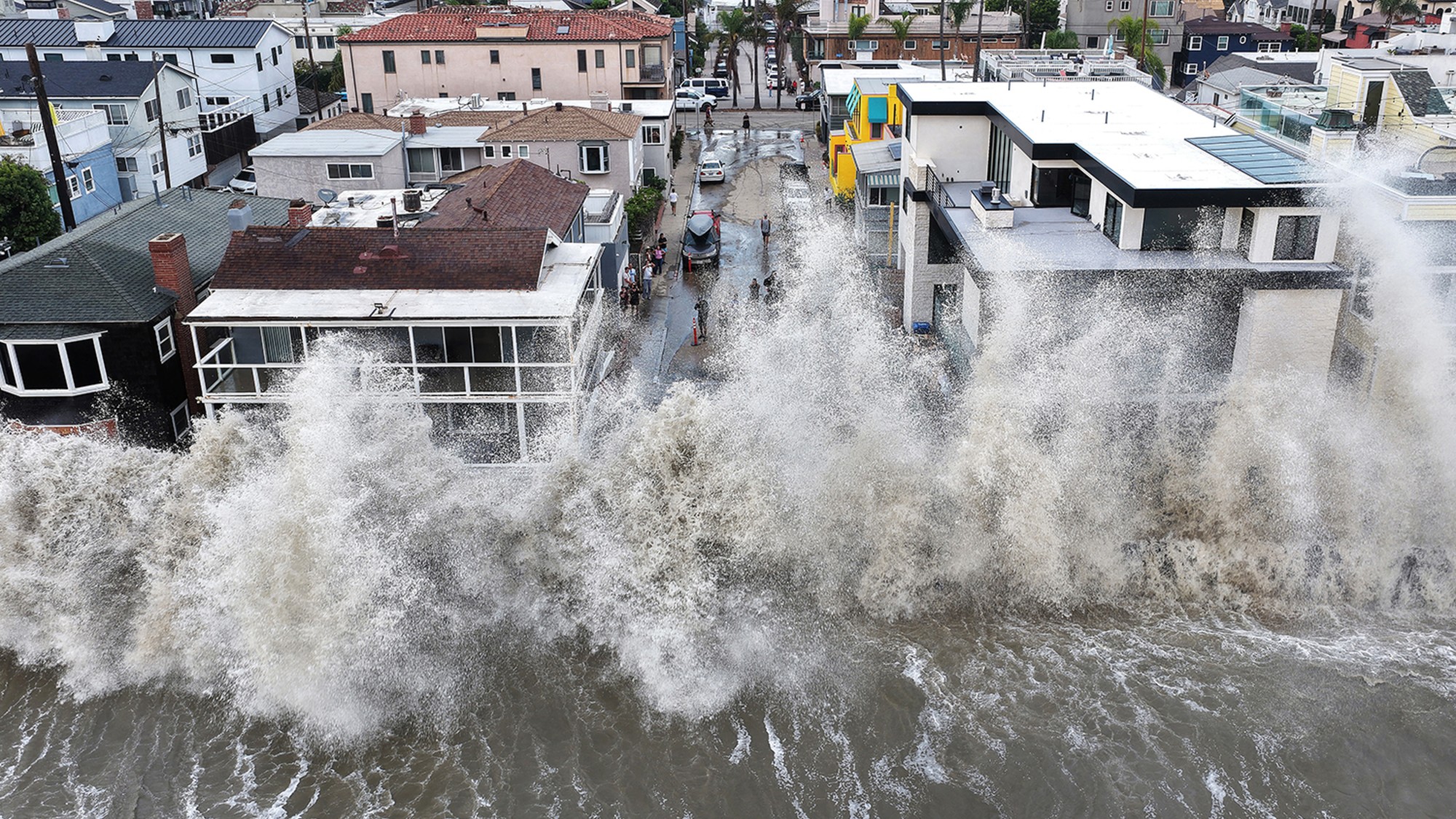
States in the Pacific Northwest, northern Rockies, Plains, and Great Lakes typically get milder, slightly warmer winters during El Niño years, while precipitation increases across the Sun Belt. If that pattern holds this time, drought and wildfire risks could increase in Washington and Oregon, while wetter conditions might alleviate yearslong droughts in parts of Texas, New Mexico, and Arizona, and coat the southern Rockies with ample snow. The prospect of a wetter, stormier winter has Southern California on edge—punishing waves can cause significant coastal flooding and erosion, leading to landslides and cliff collapse. The Golden State is also bracing for a massive pulse of warm water, known as a Kelvin wave, that is rolling toward its coast and could temporarily raise sea levels by 6 inches or more. Homes along the shoreline are especially at risk. “We need to be in the highest level of preparedness,” said Brett Sanders of the University of California, Irvine. “This is likely to be the most stressful winter we have had in a number of years in terms of waves.”