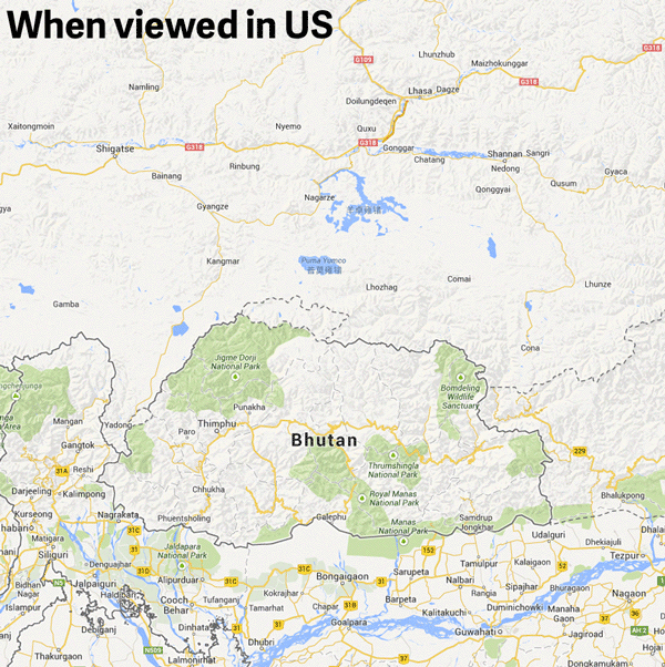
Google Maps changes China's borders based on its viewers' locations
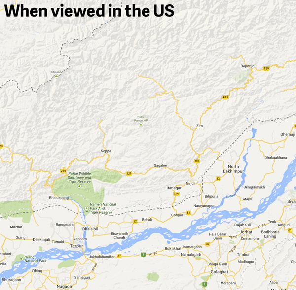
There are 32 countries that Google Maps refuses to draw borders around, but Quartz has unearthed another politically correct feature of the site: The borders of Arunachal Pradesh are different when viewed from different locations.
Quartz created GIFs showing how the region's borders change when viewed from various countries. China claims Arunachal Pradesh as a section of Tibet, and the region is shown as part of China when viewed in China. But for viewers in India, the region is shown as a part of India. When viewed from the U.S., the region is distinct from either country.

The Week
Escape your echo chamber. Get the facts behind the news, plus analysis from multiple perspectives.

Sign up for The Week's Free Newsletters
From our morning news briefing to a weekly Good News Newsletter, get the best of The Week delivered directly to your inbox.
From our morning news briefing to a weekly Good News Newsletter, get the best of The Week delivered directly to your inbox.