Iran's foreign minister is using a hand-drawn map to explain why America's drone was shot down

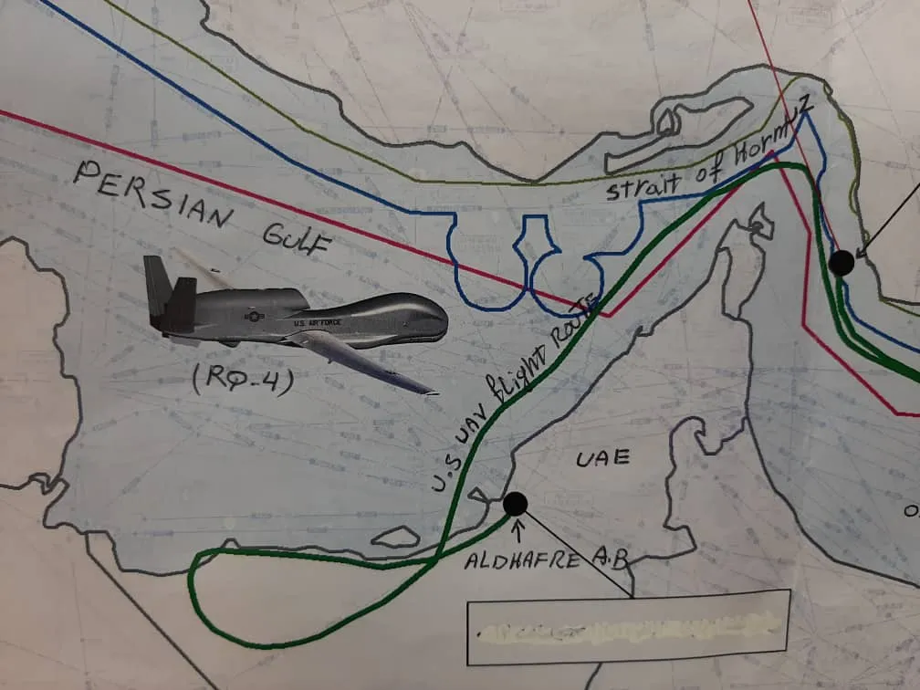
Iran's foreign minister has cobbled together an interesting explanation of Thursday's drone hit.
Iran's paramilitary Islamic Republican Guard Corps shot down a U.S. drone on Thursday morning, but the two countries have since argued over the type of drone and where it was flying. So in an attempt to explain Iran's side of the story, its Foreign Minister Javad Zarif has appeared to draw out — or at least hand label — a map of the area and tweet it out.
The Week
Escape your echo chamber. Get the facts behind the news, plus analysis from multiple perspectives.

Sign up for The Week's Free Newsletters
Join more than 350,000 subscribers and keep yourself informed with a selection of The Week’s most interesting, enlightening and entertaining stories - plus daily puzzles.
Join more than 350,000 subscribers and keep yourself informed with a selection of The Week’s most interesting, enlightening and entertaining stories - plus daily puzzles.