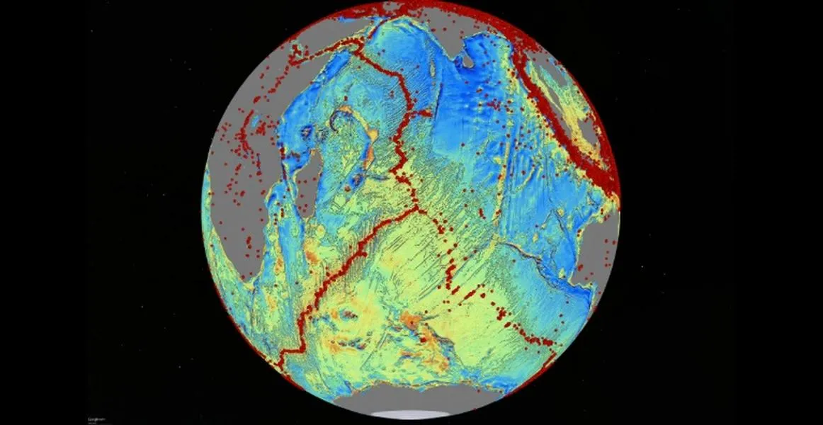
More mysteries of the deep have been solved, thanks to the highest resolution map yet of the ocean floor.
The map has revealed thousands of underwater ranges and extinct volcanoes that scientists previously did not know about, the Los Angeles Times reports. While still extremely low resolution, the new map is at least twice as accurate as the last version, put together about two decades ago.
The study, published Thursday in Science, made two big discoveries: a range in the South Atlantic nearly 500 miles long, and a ridge in the Gulf of Mexico as wide as Texas. David Sandwell, geophysics professor at Scripps Institute of Oceanography at UC San Diego, led the study. So little is known about the deep-sea floor that it's almost like a completely different planet that was only recently explored for the first time, he told the Times. "We have maps of Mars that have 100 to 10,000 times more resolution than maps of the deep ocean."
The Week
Escape your echo chamber. Get the facts behind the news, plus analysis from multiple perspectives.
SUBSCRIBE & SAVE
Sign up for The Week's Free Newsletters
From our morning news briefing to a weekly Good News Newsletter, get the best of The Week delivered directly to your inbox.
From our morning news briefing to a weekly Good News Newsletter, get the best of The Week delivered directly to your inbox.
Latest Videos From
The map was created by using data collected by the European Space Agency's CryoSat-2 and Jason-1, operated by NASA and CNES, the French space agency. The spacecraft have instruments able to measure topography of the ocean surface within a fraction of an inch. Ships are capable of carrying instruments that could get better images, but such a survey would cost too much, requiring 10 ships in order for the survey to be done in a decade.
Sandwell admits the resolution of the map "is still pretty terrible," but he's pleased with the image. "It's better than what we had before."