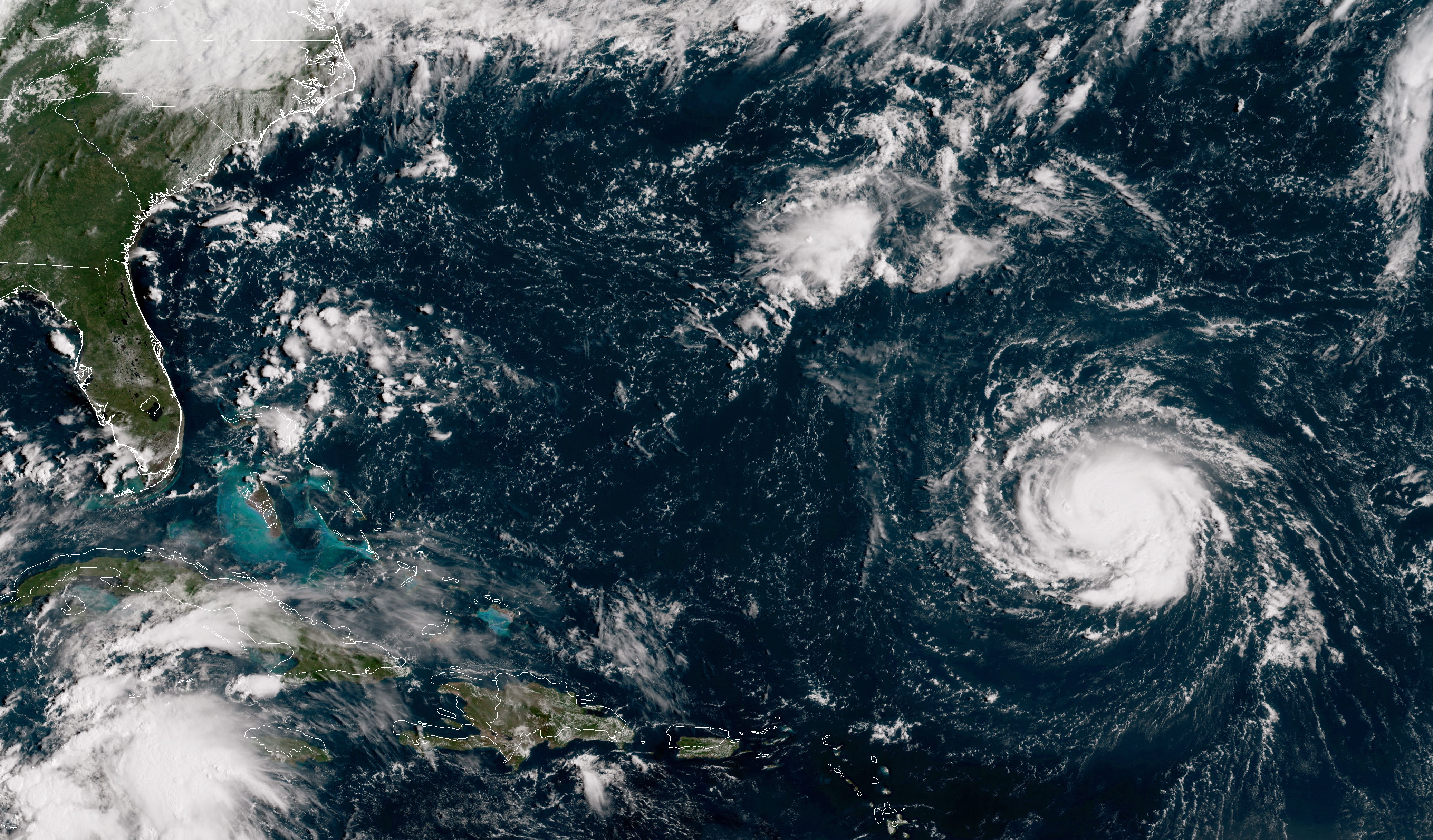
Will Hurricane Florence be the 'Harvey of the East Coast'?


A free daily email with the biggest news stories of the day – and the best features from TheWeek.com
You are now subscribed
Your newsletter sign-up was successful
Hurricane Florence's winds may have settled for the moment, but those gusts are the least of the southeast's worries.
Despite momentarily slowing winds, the Category 4 storm prompted the National Hurricane Center to place nearly all of the Carolina coast on hurricane watch Tuesday morning. The hurricane will probably be the strongest recorded storm to hit so far north, Weather Underground's Jim Masters says, bringing devastation to unprepared areas and potentially making Florence the "Harvey of the East Coast."
Last year, Hurricane Harvey hit Texas with unprecedented rainfall of up to 54 inches in some areas, leading to widespread inland flooding that caused the bulk of the storm's damage. Masters sees a similar possibility in Florence's case. Rainfall totals are expected to be around 30 inches, but Florence is also expected to slow down and hover over the Carolinas instead of driving inland and weakening. That unrelenting rainfall, combined with storm surges of up to 12 feet, could ravage an area already susceptible to flooding due to climate change, The Associated Press says.
Article continues belowThe Week
Escape your echo chamber. Get the facts behind the news, plus analysis from multiple perspectives.

Sign up for The Week's Free Newsletters
From our morning news briefing to a weekly Good News Newsletter, get the best of The Week delivered directly to your inbox.
From our morning news briefing to a weekly Good News Newsletter, get the best of The Week delivered directly to your inbox.
The center's latest update has placed nearly the entire Carolina coast on hurricane and storm surge watches. Experts predict Florence will regain its wind speed and make landfall as early as Thursday morning. South Carolina's governor ordered mandatory evacuations along the state's entire coast, North Carolina is requiring evacuations of several coastal counties, and Virginia ordered evacuations in low-lying parts of the coast, AP says. But downpours could prompt flash floods and mudslides as far inland as the Appalachians, making it hard for evacuees to find somewhere to go. Read more about Hurricane Florence at Weather Underground.
A free daily email with the biggest news stories of the day – and the best features from TheWeek.com
Kathryn is a graduate of Syracuse University, with degrees in magazine journalism and information technology, along with hours to earn another degree after working at SU's independent paper The Daily Orange. She's currently recovering from a horse addiction while living in New York City, and likes to share her extremely dry sense of humor on Twitter.
